Turtle Shell

Beloved Ariel 65


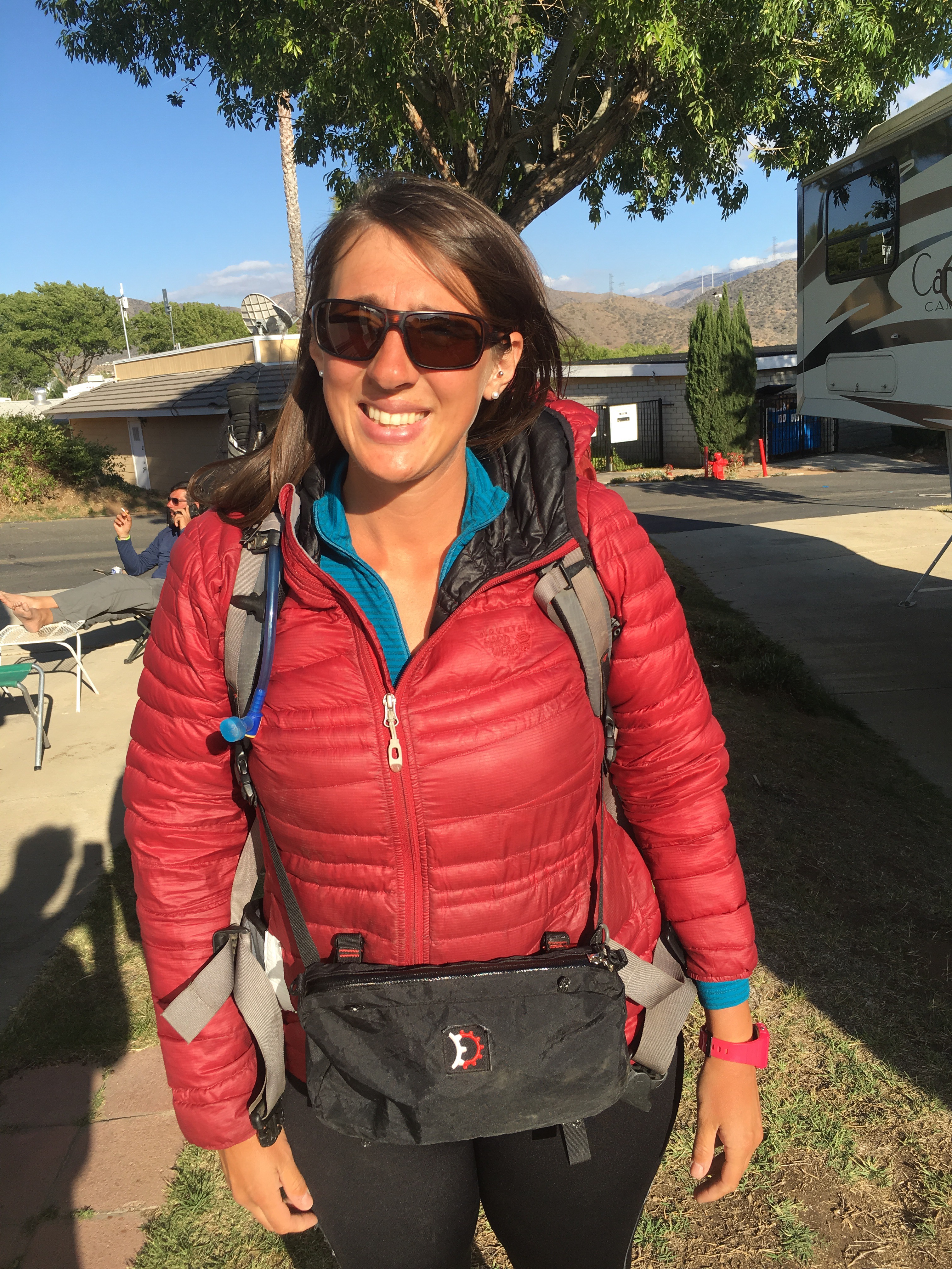
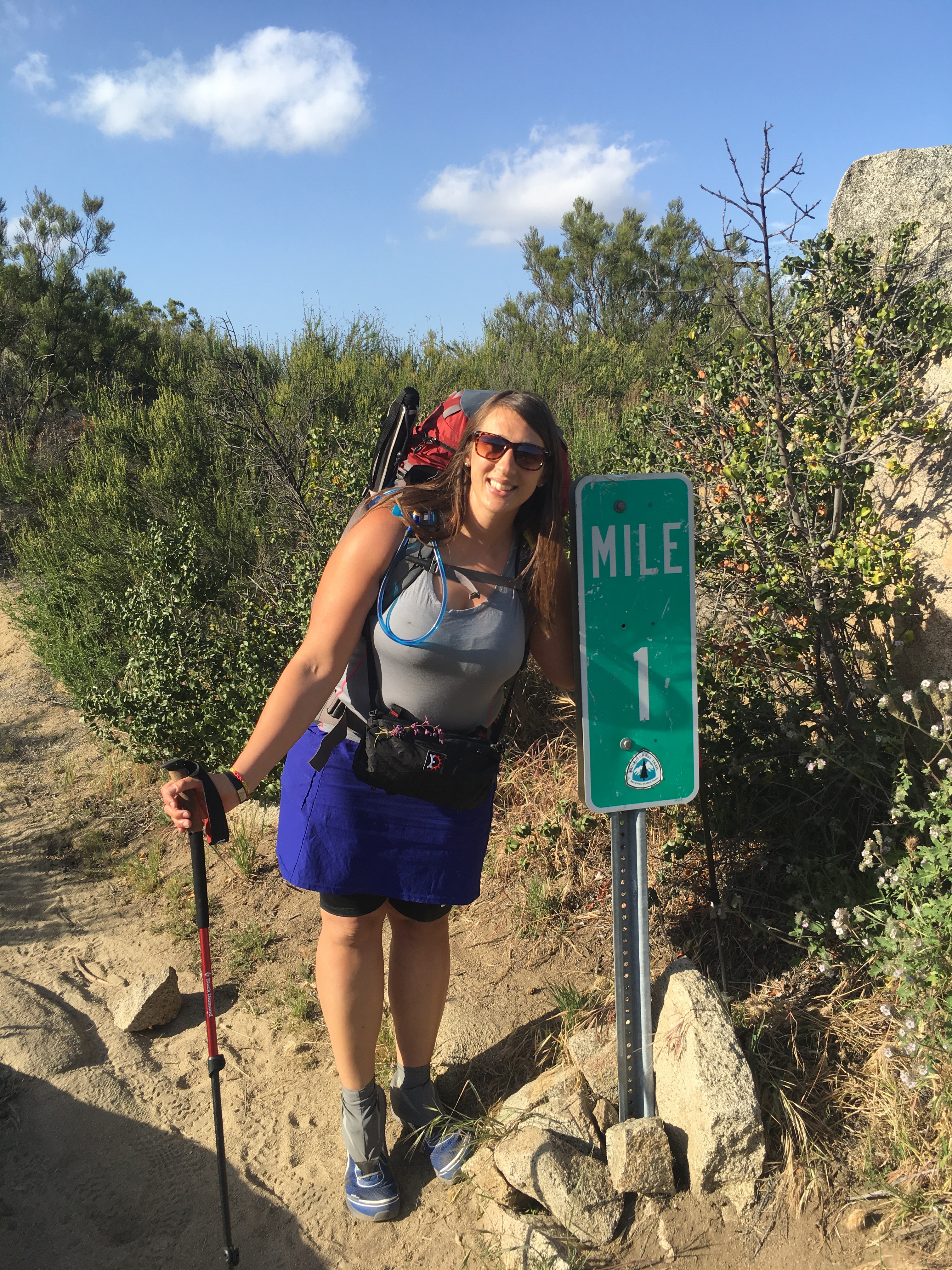
The day I discovered my beloved eight year old Osprey backpack had a fray in the right should strap was the beginning of a harsh reality; I’ll need to replace my backpack or as I call it my Turtle Shell. 

The replacement


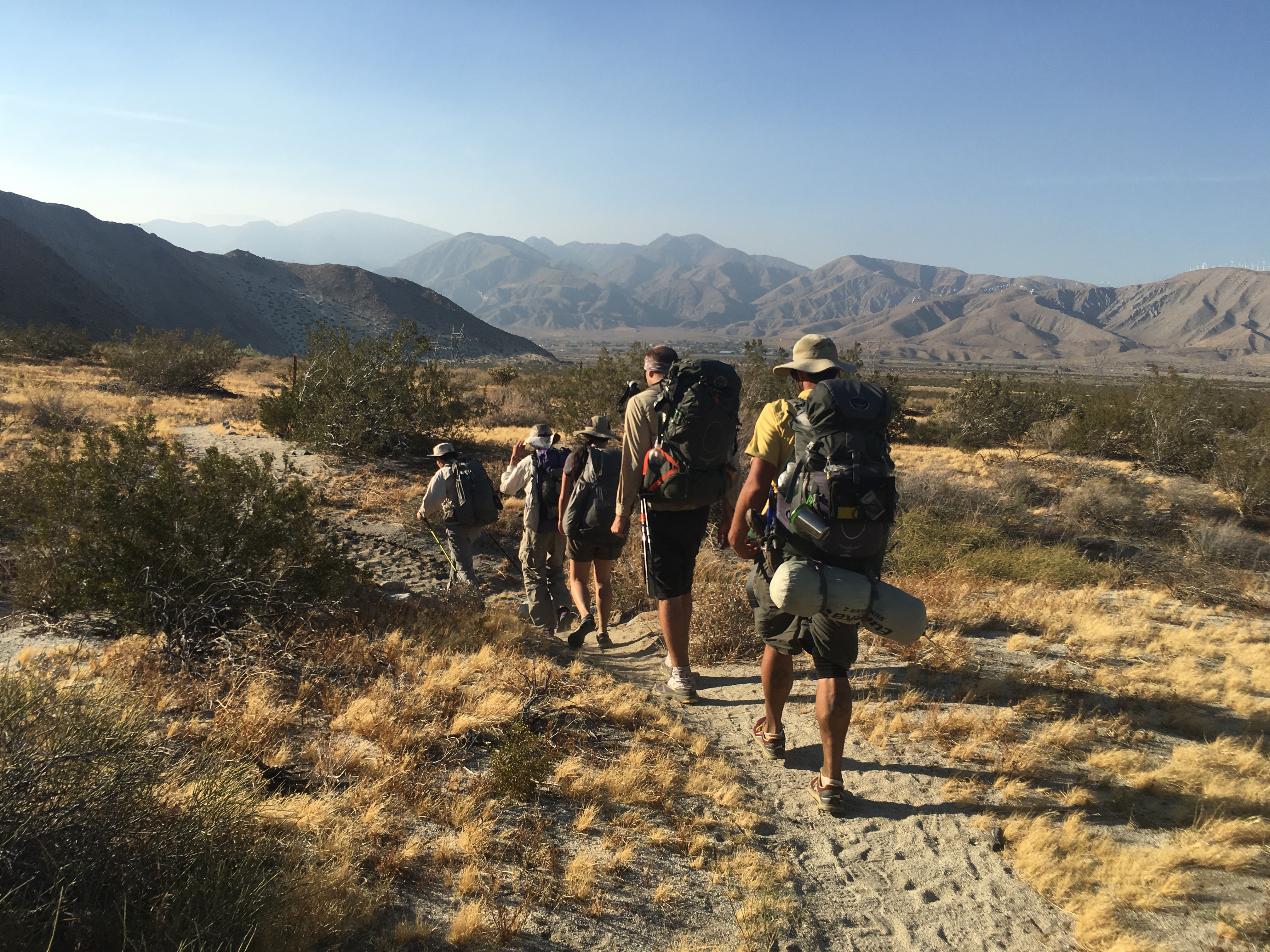
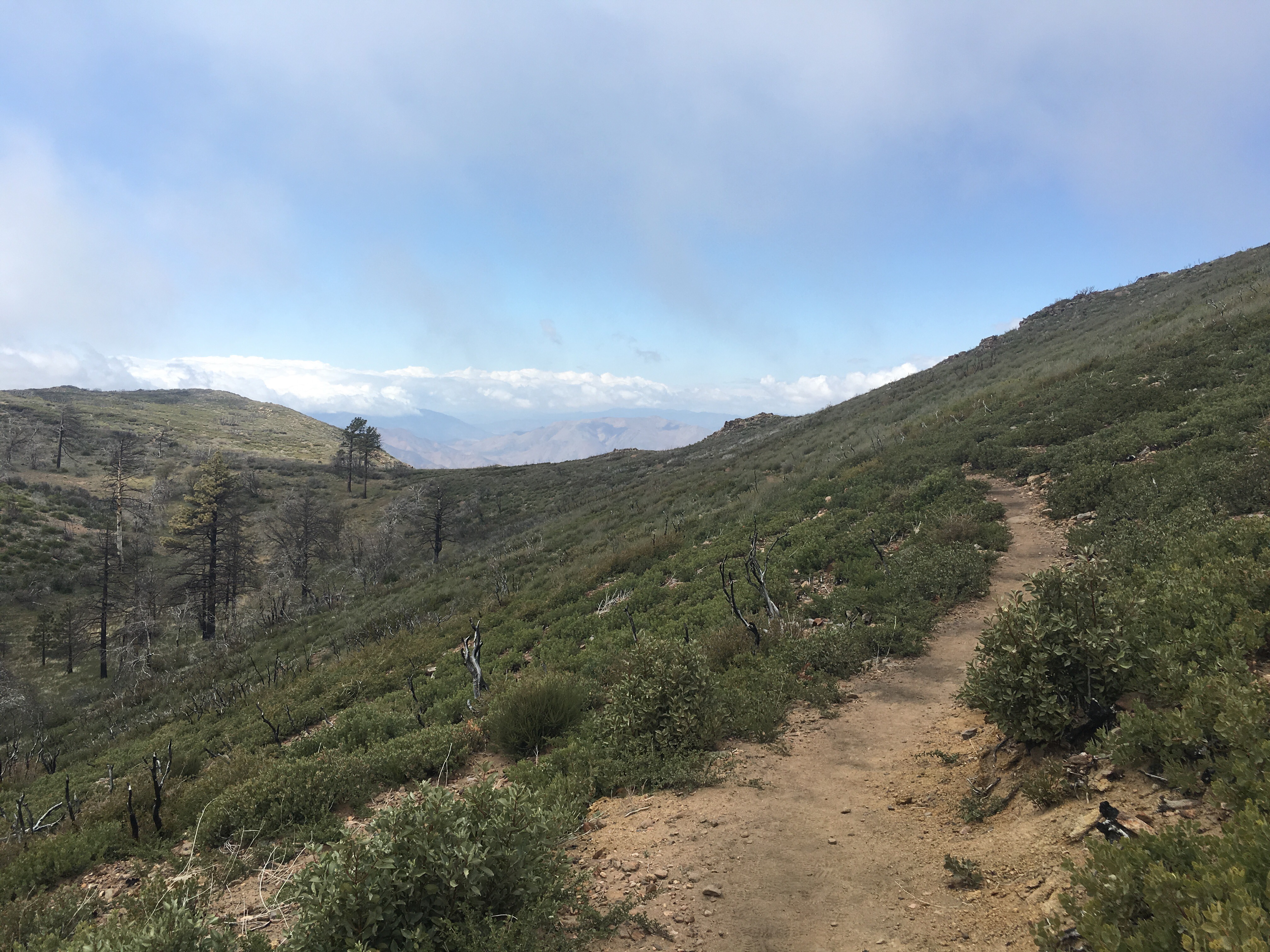
Sometimes that’s what I imagine we all are just little turtles, shuffling about on this long trek north. Often, when Phil passes me going up a steep (any) hill I think it’s not the hare that wins the race but the slow and steady tortoise. 

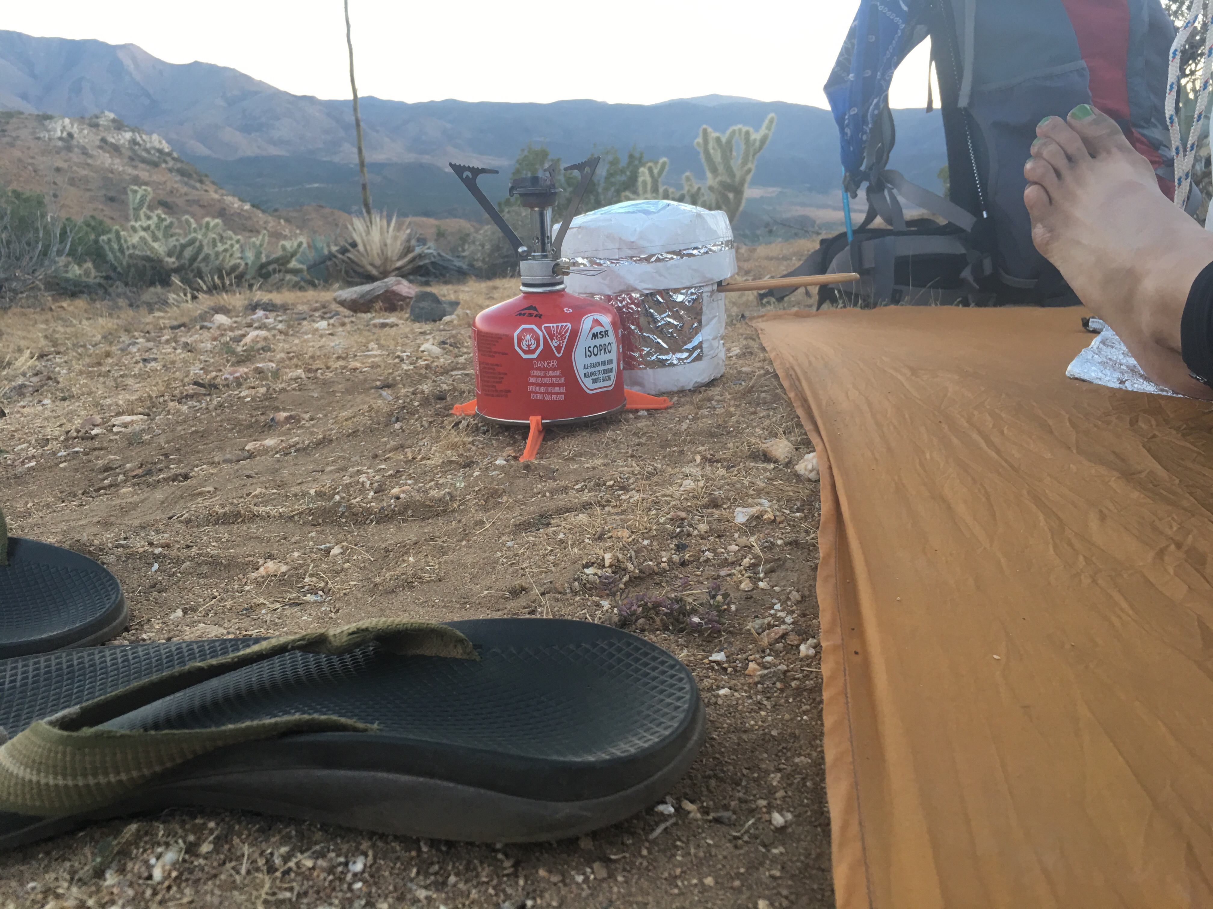
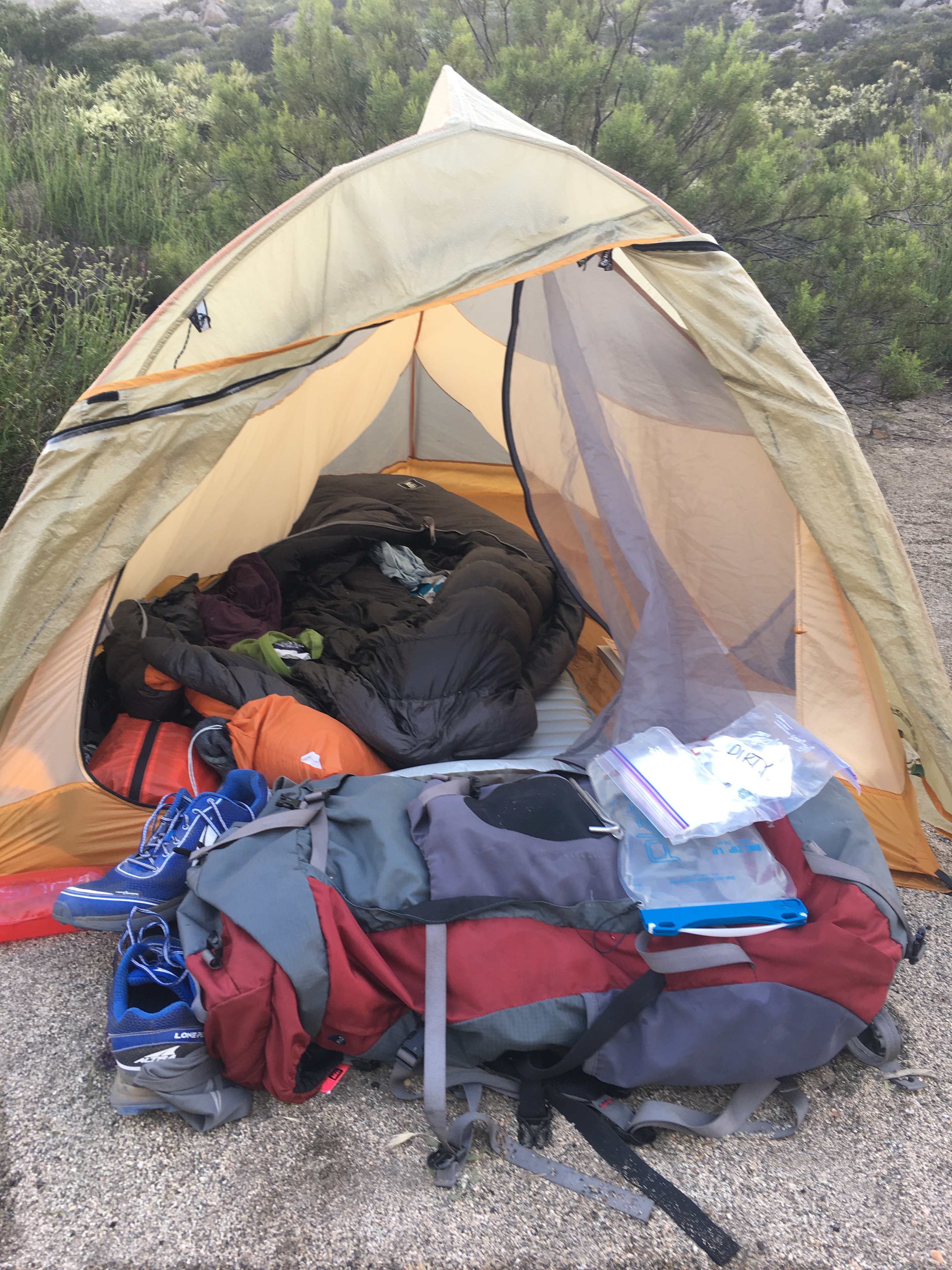
Your backpack becomes a part of you; it’s everything you need to take you day to day, mile to mile, water source to water source. It carries; my tent, sleeping bag, sleeping bag liner, extra clothes, food, water, medical kit, books, maps… Everything! Phil and I ever so carefully planned every square inch of our turtle shell capacity so when I needed to temporarily trade my shell out for a newer model I approached this concept with some excitement and a bit of apprehension. Will this shell fit the same, carry my load as I’m used too? 

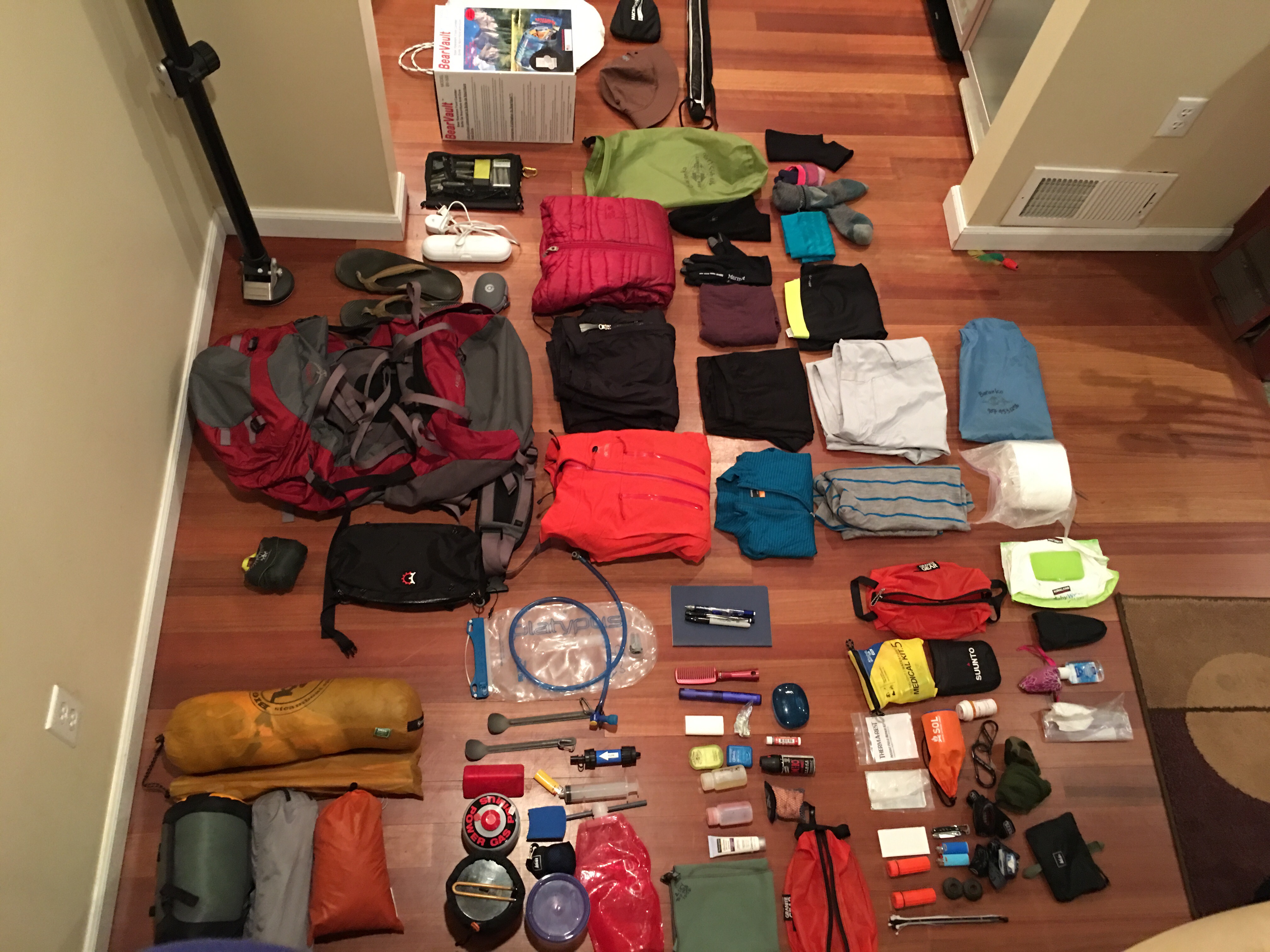
the contents of my shell


Osprey makes great backpacks and I’ve been increadibly impressed with their warranty department. As to not miss a step on this trail, Osprey gave me a loaner bag while mine is sent back for repairs to their Colorado based shop. In the mean time as this new shell has a few new bells and whistles I’m not sold on the hip belt fit and the capacity shape, my gear just doesn’t quite fit the same. After the first day my hips where burning with pain and decided I’ll need to carry the weight on my shoulders instead. My fingers are crossed that I will be reunited with my bag before we start out of Kennedy Meadows for our trek through the Sierras. 

Advertisement

A Changed Landscape


Walking through Southern California has presented a more diverse ecosystem than I was expecting and what is ever present is the mark wildfires have left on the landscape. From day one you know they were present, charred remains hiding under lush new vegetation, and it makes me wonder when did a fire last touch this soil?

 As we walked northward around mile  270 just out of Big Bear we experienced our first pine forest, magnificent tall trees, majestic, shading us as we walked. It was like a dreamland, not having to wear sunscreen or guzzling water from the heat, these pines cooled our hike and I fell in love with this forest. But as with everyday, the more you walk, the more miles you cover, you cross many ecosystems and watersheds (dry as they may be) and often times you turn a corner or saddle onto a new mountain ridge to find a completely new landscape. On this day around mile 280 I walked through my first standing dead landscape, an entire pine forest of charred remains. 


Not only that but as I rounded that corner a dry hot wind hit me and I started to realize the importance of fire awareness here in Southern California. Those dry hot winds something I’ve been experiencing everyday for the past two weeks; they start up in the afternoon and die down around 8:00pm, are they the same ones crews fear of spreading these fires? 


It hasn’t gotten easier for me walk through burned areas and most show signs of life as the understory comes back to life with green vegetation, of which I’d love to learn more about the succession in these areas. Coming from Alaska I’m no stranger to wildfire and after talking with friends up there they all talk of wanting rain for a fear of what a dry hot summer could bring. I wonder what will be happening north of here as we walk, will we need to bypass more closed sections of trail because of burned or unstable landscapes? I know many hikers last year had to detour around fires in Oregon and Washington, what will this year bring? 


Wildfire is not something I take lightly and Phil tried to give me the trail name ‘Smokey’ (Smokey the Bear) on day four of our hike as I caboshed his plans for making a fire in a very dry section of desert with light winds near where I planned to set up my tent. We had hiked into a desert valley, still 8 miles from water and running low ourselves. We found a great campsite with a old stone fire ring and Phil announced he would be having a fire that night I quickly retorted ‘Really, do you think that’s a good idea?’ To which he responded, ‘Okay, Smokey! That should be your trail name.’ That name wasn’t going to stick, however Phil now dawns the trail name ‘Fire Whistler’. A name given to him while we enjoyed a campfire with other hikers in a designated safe area for a campfire. Phil is an incredible fire master and he got the name because he looks like he’s whistling when blows on the embers to get the fire roaring. 


As I walked down through that burned area the landscape once again changed and became that beautiful forest of tall pines which I so thankfully slept in peace beneath that night. Looking up into the sky from the warmth of my sleeping bag I thought how incredibly blessed I am to be experiencing such beauty. 

-Lucy

Three weeks on the trail

We just made it three weeks on the pct, and we are halfway through the desert 350 more miles and we’ll start the Sierras.

image  Lu posted the question, what are we thinking about while hiking?   So, if your interested here is a stream of consciousness, from my mind.
  Wake up,  pack up gear, wow the sunrise is pretty, God I’m still sore, my feet hurt. Put pack on, man my pack is still heavy at least it doesn’t feel so bad when it’s on.  17 miles today that’s not to bad, I’ll lossen up after the first mile.  Say bye to everyone in camp.   It’s super nice weather today, left foot right foot.. Oh that pretty. 

imageimage

   I wonder how everyone back home is doing, I should call people next time I have service.  Is it to early in the day to have a snack, what’s that smell, oh it’s  me, what snack should I have, yeah I love almond snickers.  These plants to are cool, I wish I knew more about plant species.  Who sings that song I like, how does it go ” Alabama Arkansas I sure do love my muw and paw”  could I name all the states,  maybe, the stupid small ones on east coast are tricky.  Wow, I should get a picture of that.

imageimage

  When is this stupid trail going to stop going up hill?  I think I like up hill more, yeah down hill hurts my knee.. there’s  another hiker I should talk to them. “Hi”  “hi”
“See you later”  “yeah”.  I hope I have enough water, I should look up the next water stop, how far have I gone all ready?  WHAT?!  Only 2 miles.  I wonder what everyone  back home is up to.  

image My water stop later that day.  It took five minutes for the gallon jug to fill up, then I still had to filter it.

200 more miles…

Wow! 200 miles have flown by since Warner Springs, here we are at PCT mile 330 chilling with our dad at Silverwood Lake campground siping on gin and juice, no wait, sorry, sipping on Dr. Pepper. Crazy how on the trail you crave the most terrible things, like a seven month pregnant woman. Who the heck drinks Dr. Pepper in the outside world? Not this girl but on the trail it’s all I think about!! Umm… Sweet, sweet Dr. Pepper! 

A windy hike to Ziggy and the Bear


Well, after a grueling 24 mile hike off San Jacinto Peak (elevation 10,800′) we met up with our dad! He was waiting for us at Ziggy and the Bears place at mile 210, a couple of older sassy Trail Angels who know how to host ‘hiker trash’. They provide the most sought after hiker needs; pizza, soda, ice cream, hotish showers and laundry!! It was all a sight to see and a great way to reunite with other hikers as dad was having fun being Bears helper and chatting with hikers. It’s been a grand time having dad and the RV to help us along and provide us with our own Ziggy and the Bears mobile services… Dr. Pepper! 

Mt. Jacinto the one with snow on it


Another milestone was our first resupply in Big Bear. A very, very BIG thanks goes out to our cousin Drew, long time family friend Katie, Alaskan friend Brie and our pals in San Diego Penny and Jeff for the awesome care packages, letters and well wishes! Thank you so much for making us feel so loved! A special thanks to Penny and Jeffs kiddos Rowan and Declan for decorating our packages with sweet stickers! Thanks guys! Please keep the love and support coming as we have a few long desert days coming up where we’ll be carrying six liters of water up 6,000′ of elevation gain. But you know the best part, having our dad waiting for us on the other end of that mountain. 

10,800′ Mt. Jacinto with trail friend ‘Chopper’


Over the past few weeks I’ve been thinking of lots of blog topics and wanted to vet a few. 

– Trail Names

-What we thinking about during our 18 mile day hikes in the blazing sun

-Trail Food

OR

What would you like me to write about? Suggest a topic! 

Reading at sunset to my cowboy camping trail friends


Hope everyone is well and if you are feeling in a giving mood please see
my ‘Charity Causes’ page and donate a mile or two. I’ve raised 295 miles and hiked 330 so I’m a little behind. 

Thank you! 

-Lucy

Just some awesome pictures

Mt. San Jacinto, just after our zero day.
One day up the Mt. one more to get down.  Totally amazing

image

Peak San Jacinto

image

image

We are at mile 210, and our dad was waiting for us at Ziggy and Bears place;  super cool Trail Angels. Today we are driving around the fire closure and will restart the trail this afternoon.
-Phil

Nero Day (Not quite a Zero Day) 

Phil hiking a meadow near Warner Springs


100 miles completed and a nice layover in Warner Springs at mile 109. Phil and I have been putting some hefty miles on the past couple days; May 2nd- 18 miles, May 3rd-18.5 miles and our bodies are feeling it. Phil and I agreed not to do over 15 miles a day the first couple of weeks, however because of water sources and food resupply locations you have to make exceptions. All the extra miles and weight of carrying water (sometimes 6 litters a day) has taken a toll on my right ankle. After talking with my friend Rachel who’s a sports therapist, she diagnosed I have a stressed posterior tibial tendon. So, our Nero Day (nearly zero day=half day off, some hiking) was filled with icing, stretching and resting my ankle. We’ll take off here in a few hours to put in a cool day of ten miles on our way to Paradise Cafe on Hwy 74 the Pines to Palms highway (PCT 151). 

Cowboy camping PCT Mile 82.5


The past few days have been of extremes, crossed two mountains in the hottest weather we’ve had thus far and nearly cried when a Trail Angel appeared with a gallon of water for each of us when we were nearly out of water and still a ways from a possible source. Cowboy camped (sleeping outside without a tent) on a beautiful mountain ledge watched the stars at night and a glorious sunrise the next morning. 

May 3rd Sunrise at PCT Mile 82.5


It’s amazing how our bodies and mental toughness have been challenged so far, it truly makes me feel alive and puts my life into perspective. Every time I think “this is hard” I’m reminded of my Special Olympics athletes and how hard the work and push themselves to be better skiers. My life is so blessed and I’m so lucky to be here where I am. 

Anchorage Special Olympic Ski Team = my inspiration


As my brother Mark told me the other day the most important thing I can do on this trail is take care of myself. So, today’s Nero day was every bit worth it. It’s a long journey and I want to see what’s around every corner! 

San Felipe Hills


Thanks again for your love and support! 

-Lucy 

Wednesday May 4

   Toady we are at Warner springs, that’s 109 miles the first week into the hike.
     I got my first shower if you can call it that, it was a 5 gallon bucket and a pitcher to pour water on myself.  It was still the best shower I’ve had in awhile!
     So, Lu I think talked about how the desert  was cold. Well, I can tell you now that we are definitely in the hot part now, it still gets cool at night, but during the day we are drinking more water, and shade is a commodity.
The views have been amazing.

image

image

   Two nights ago I cowboy camped up on a mountain, in the middle of the night I woke to the most beautiful display of stars, which gave off enough light to see the contours of the peaks and valleys.  I didn’t want to go back to sleep. But the morning rewarded me just as much.

image

PCT Mile 50!!! 

Day four on the PCT and Phil and I are camped at mile 50 high in the mountains! We pulled a long day yesterday 16 (18 if you count the water refill detour) so we could have a nice long layover stop in Mount Laguna. Woke up early and trucked the six miles into town for food and water, cute little stop. We learned over the past few days that we each must carry our own trowel! Since I’m the one carrying it and usually hike a mile or two slower than Phil it made sense for him to have his own. 

Southern Terminus with Rowan and Declan


Wow! The desert gets wicked cold at night add the wind and it nearly feels like Alaska here in Southern California. We’ve both been cold from the start, cool overcast days with a light breeze, well yesterday was nice and sunny but still breezy. We hung out at the lodge this morning to get warm, drink some coffee and catch up up reading and writing. A welcomed break. 


Lucys Castle

Yesterday we hiked a section of trail just north of Kitchen Creek road near mile 30, I loved it. I love how this trail is so beautifully countoured with its surroundings, the way it winds around, up and over passes, just lovely. 

trail section near mile 30


We don’t know what tomorrow brings; easy water sources and camp sites, cool cloudy weather or hot sunny weather, but we’ll take each step in stride and thank God for these amazing landscapes and the opportunity to experience it. 

-Lucy

PCT mile 44